The fast, flexible and intuitive web application, accessible from a computer or tablet, always on hand and easy to configure.
Provides a full picture of the field and complete details of the most important indicators.
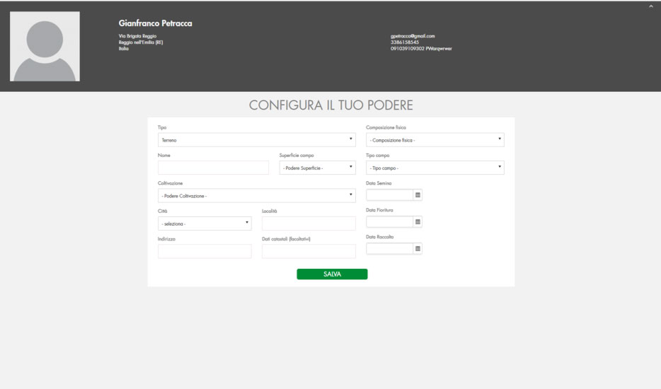
Easy configuration of fields and farms.
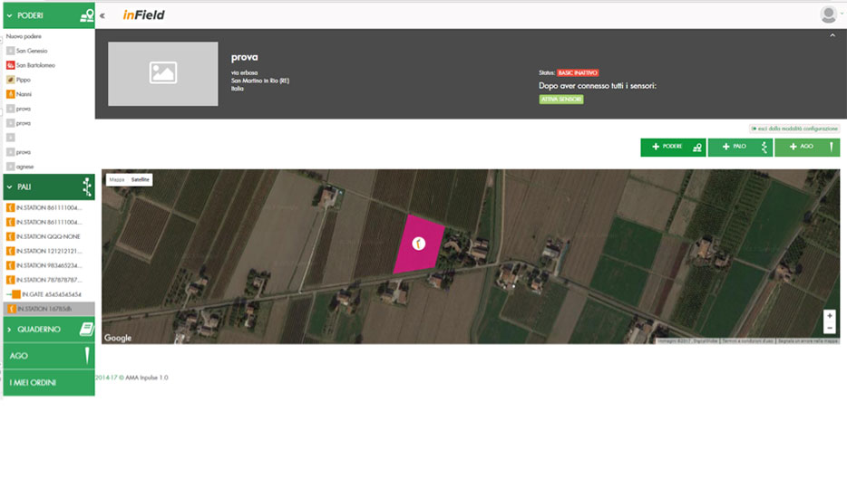
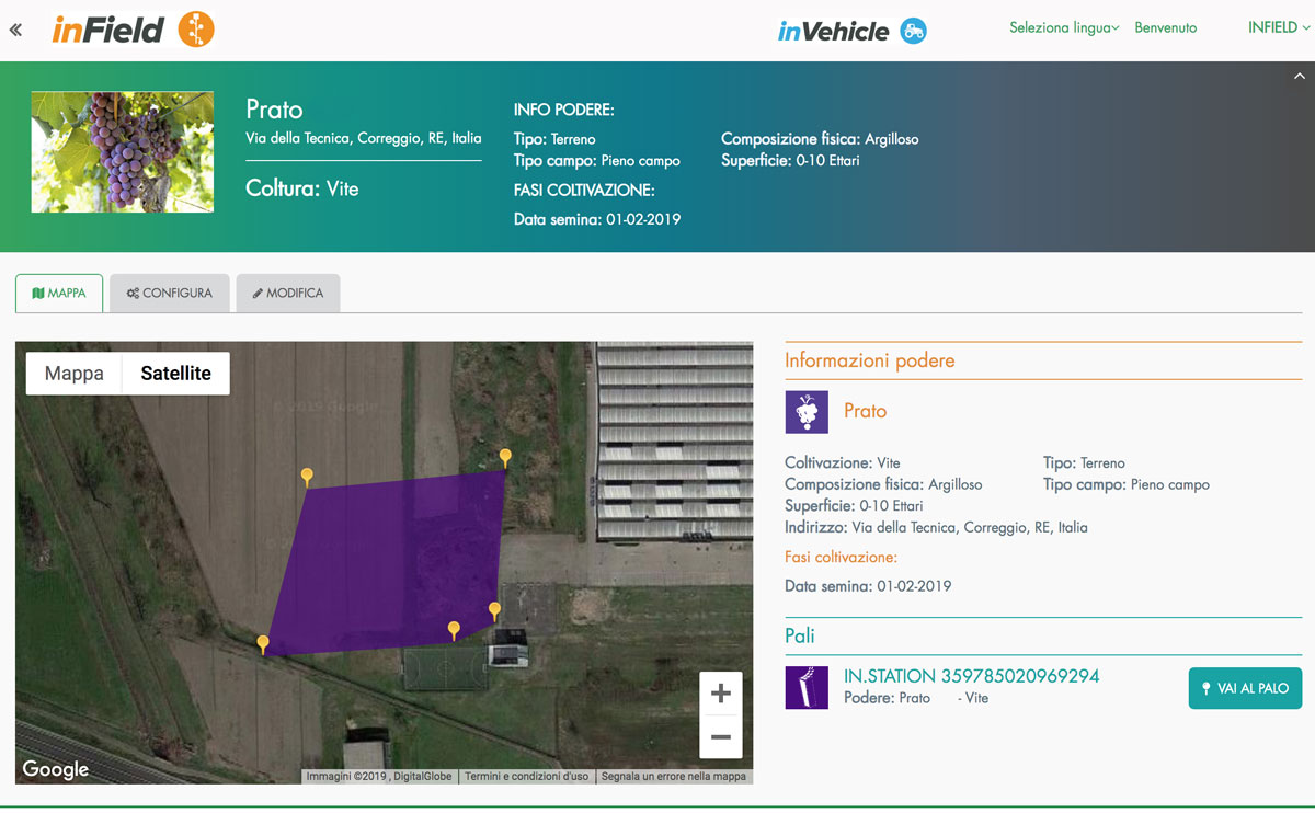
Fields and farms can be drawn easily, even when they are irregular in shape.
Each field can be associated with a crop, indicating the date of sowing, transplanting, flowering, when the harvest started and other characteristic information.
Intuitive positioning of the InStation and InGate measuring stations in the fields.
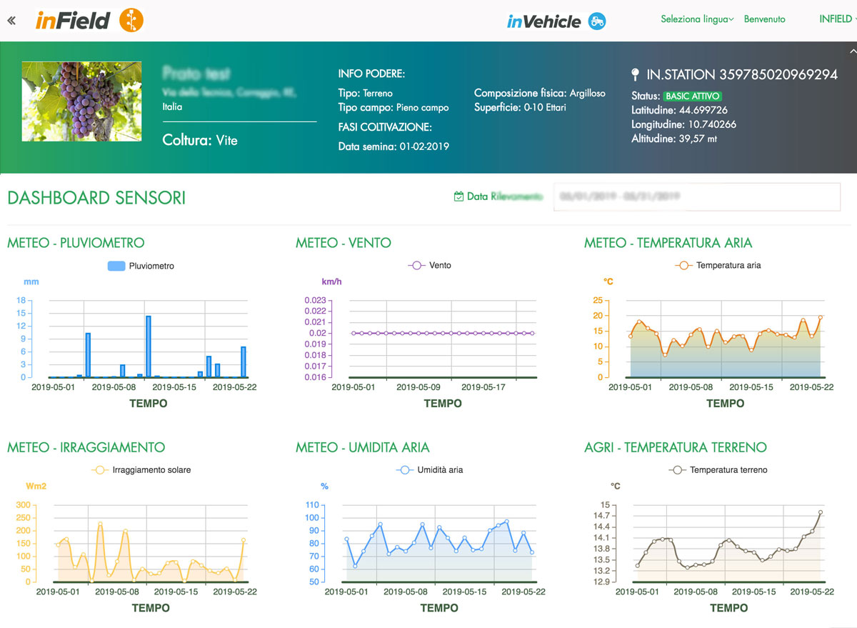
Reports on the sensors in the field and measurements taken.
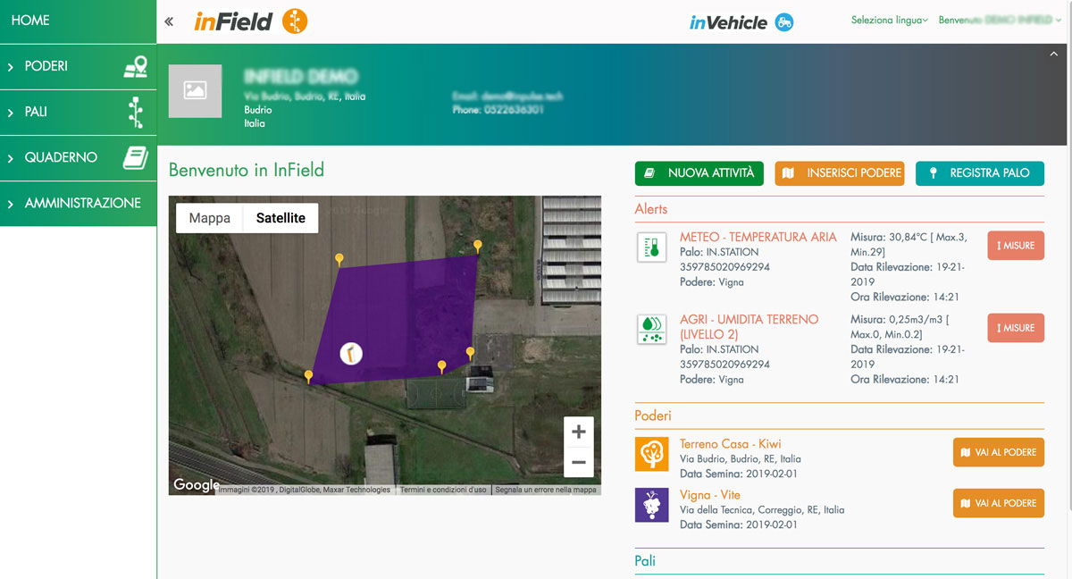
- SUMMARY OF DATA on a single customized screen Full view of the position of InStation and InGate stations in the field. Display showing all of the active sensors and details of the measurements taken
- Continuous MONITORING of the condition of the crops. Constant updating of data and log display.
- EFFECTIVE PLANNING of work in the field Alert values based on data collected (if configured)
Many ways to see the data collected:
Option to display and analyse the data collected in summary reports that are easy to consult and graphs.
Option to download the reports in Microsoft Excel® format for amendment or display.
Maps and Geolocation
Maps of agricultural land, fields, crops, structures and measurement stations positioned in the fields. The user will have a complete view of the property and the surrounding area.
The system is based on a satellite view, making it possible to see every corner of the world and pinpoint specific areas of land.
Parameterisable alerts
Automatic alerts set by an algorithm, which provide recommendations concerning spraying and irrigation (Smart and Personal service).
Alerts set manually by the user through ad hoc parameters (Basic service).
The user may receive notifications via text, email or the portal when threshold values have been reached.
- Exceedance of manually set thresholds
- Malfunction or tampering with measuring stations
Electronic logbook
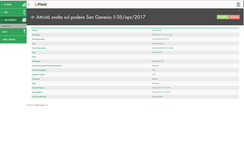
An electronic logbook for registering all of the activities performed in the field is available on the InField platform.
The electronic logbook with sensor measurements enables optimum performance of the algorithms used to propose recommendations concerning irrigation and spraying.
Option to record information about the irrigation and spraying activities performed (type of irrigation, date, water supplied, schedules, etc.), preparing all of the relevant printouts and load documents needed for agri-environmental compliance and measurements:
- Ground type and crops
- Surface area
- Agro-mechanical operations
- Treatments
- Products used
- Amounts used
- Surfaces treated
- Difficulties
- Phenological phases
- Other
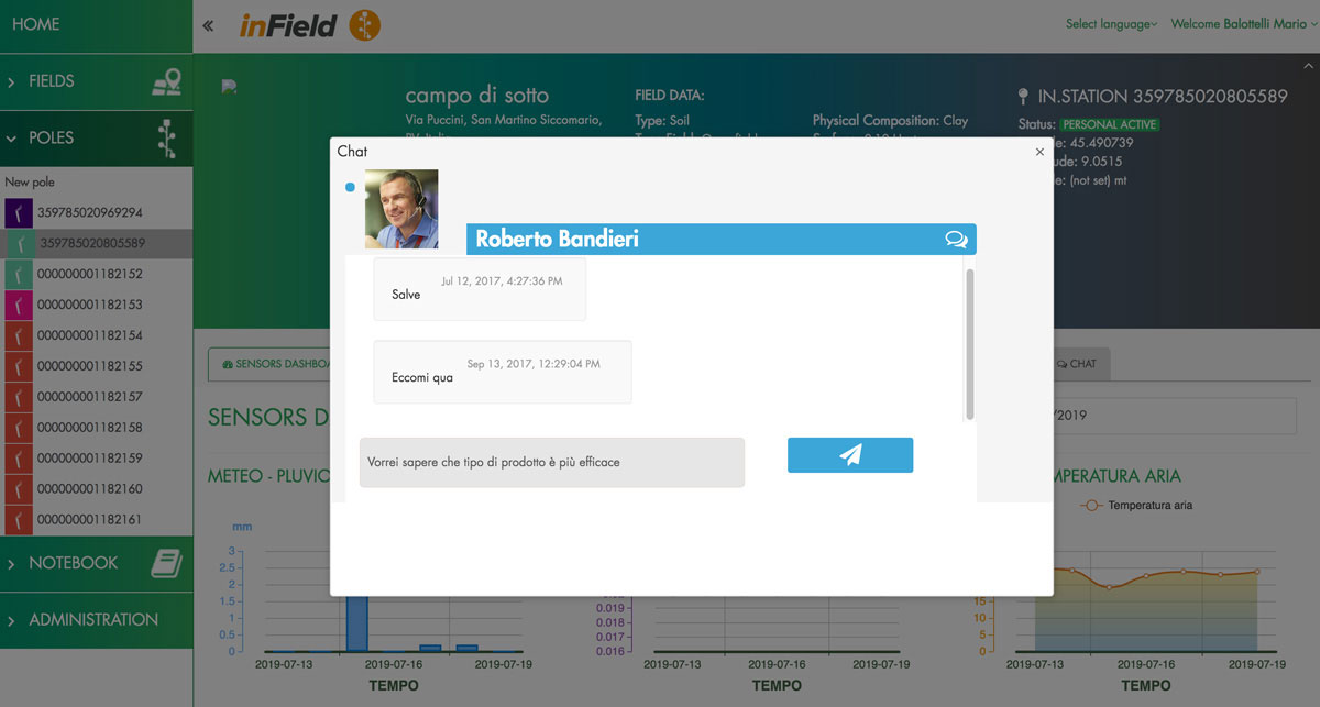
Personalised and specialised advice
A group of agronomists with years of experience placed at the disposal of our customers, to guarantee the best agronomic results and meet the most complex needs.
Chat service available Monday to Friday from 9 am to 12 pm (available with the Personal subscription)
Subscriptions

Includes:
- Registration of details and configuration of fields and structures.
- Logbook
- Parameterizable alerts
- Geolocation sensors and measuring stations installed.
- Satellite view and mapping of fields and crops.
- Remote monitoring and control
- Overview of raw data measured
- Graphs and summary reports
- Free
for the first year - from second year € 99 (annual price)

Includes:
- Registration of details and configuration of fields and structures.
- Logbook
- Automatic system alerts
- Geolocation sensors and measuring stations installed
- Satellite view and mapping of fields and crops
- Remote monitoring and control
- Overview of raw data measured
- Graphs and summary reports
- Prevention advice recommended by the algorithm
- Planning of work in the field
- Report that can be downloaded in Microsoft Excel format
- 199€
- from second year €298 (annual price)

Only available in Italy.
Includes:
- Registration of details and configuration of fields and buildings
- Logbook
- Automatic system alerts
- Geolocation sensors and measuring stations installed
- Satellite view and mapping of fields and crops
- Remote monitoring and control
- Overview of raw data measured
- Graphs and summary reports
- Prevention advice recommended by the algorithm
- Planning of work in the field
- Report that can be downloaded in Microsoft Excel format
- Personalised advice from an agronomist via web chat (Monday – Friday from 9 am to 12 pm)
- 499€
- from second year €550 (annual price)
